10 of the tallest mountain ranges from around the world.
Mountain ranges are a series of mountains occurring in a line or arranged in a line and connected by high ground. They are formed by a number of geological processes with the majority being formed through plate tectonics. Most of the world’s tallest mountain ranges are located in Asia following the ongoing collision of continental and oceanic plates. The following is a list of mountain ranges by height.
10. Alaska Range – 6194 meters above sea level
The Alaskan range is one of the components of the Alaskan Mountains stretching 400 miles from Lake Clark in Alaska to the White River in Canada’s Yukon Territory. Alaska Range is a segment of the larger Pacific mountain system of North America and hosts the third highest peak of the world’s seven summits, the Denali. The mountain range is part of the Pacific ring of fire and the Denali Fault responsible for a number of earthquakes on the southern edge, and forms the climatic barrier that separates the interior tundra from the Pacific coastal region. Alaska range’s enormous glaciers and panoramic Arctic sceneries attract tourists and mountain climbers.
9. Andes – 6962 meters above sea level
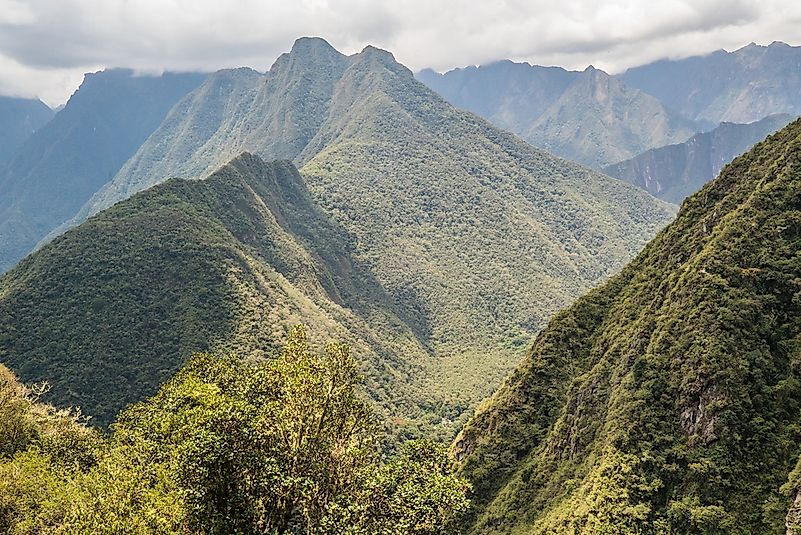
Andes Mountain ranges are the longest continental mountain range in the world located in South America. The Andes ranges stretch for 4,300 miles from the southern tip of South America through Colombia, Venezuela, Ecuador, Argentina, Peru, Bolivia, and Chile to the northern coast of the Caribbean. The Andes are the highest peaks of the Western Hemisphere and home to the highest mountain peak in South America, Mount Aconcagua. They also form the American Cordillera consisting of a continuous sequence of mountain ranges that form the backbone of North America, South America, Central America, and Antarctica. Due to the rotation of the earth, Chimborazo peak in the Andes lying in the equatorial bulge is considered the farthest point from the earth’s center.
8. Nyenchen Tanglha – 7162 meters above sea level
The Nyenchen Tanglha (Nyainqêntanglha Mountains) forms the eastern section of the southern part of the Tibet Autonomous Region in China. The mountain system comprises of the Northern range of the A-ling Mountains and the southern range comprising of the Kailas range, a rather rugged and glaciated region. The Nyenchen Tanglha is the subject of folklore among the inhabitants of the Tibetan region. It is also considered the most influential deity in a large part of northern Tibet.
7. Kunlun – 7167 meters above sea level
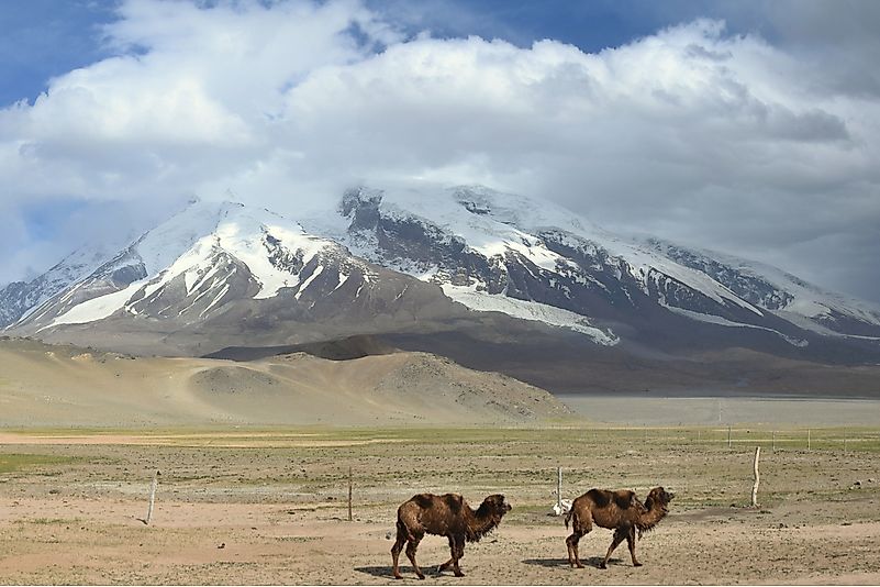
The Kunlun Mountains are the longest chain of mountain ranges in Asia stretching for 1,900 miles through central China. It forms the northern edge of the Tibetan Plateau. Throughout is alignment, the Kunlun comprises of three parallel ridges rather than a single crest as most ranges. Due to their location, the Kunlun ranges are almost totally isolated from the climatic influence of the Indian and Pacific Ocean monsoons but rather the climate is influenced by the continental air masses. Most of the Kunlun region is covered in steppe and rocky terrain character of desert conditions.
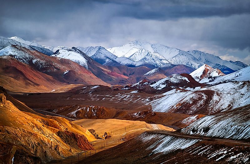
6. Tian Shan – 7439 meters above sea level
The Tian Shan (Celestial mountains) form the ranges of Central Asia stretching from the China–Kyrgyzstan border through to the ancient Turkistan territory. Tian Shan mountain ranges consist of a series of ranges coupled with intervening valleys and basins. The Turpan depression in the Tian Shan is the lowest region in Central Asia lying at 504 feet below sea level. The alpine mountain ranges composed of sedimentary and crystalline rocks form crests within which glaciation occurs. Glaciers in the mountain have been shrinking rapidly and it is estimated that by 2050, half of the remaining glacier on the mountain will have melted.
5. Hengduan Mountains – 7556 meters above sea level
Hengduan Mountain ranges are a series of ranges in Southwest China connecting the Tibetan Plateau and the Yunnan–Guizhou Plateau. The ranges separate the lowlands of Myanmar from those of the Sichuan Basin. These ranges were formed by major volcanic activity occurring in the Indian sub-continental plate colliding with the Eurasian Plate. The components of mountain ranges in the Hengduan are separated by deep river valleys that channel water from great rivers in Southeast Asia forming the Three Parallel Rivers of the Tibetan Plateau.
4. Pamirs – 7649 meters above sea level
The Pamir mountain range center on the nodal orogenic uplift (Pamir Knot) from which several Asian mountain ranges such as the Karakorum, Hindu Kush, Tian Shan, and Kunlun ranges rise. The word Pamir means high undulating grasslands of the eastern portion of the mountains, especially where they adjoin Afghanistan and China. The Pamir lie within the Tajikistan region, but its outer edges penetrate to China, Afghanistan, and Kyrgyzstan. The core of the Pamir mountain ranges is in the highlands of Tajikistan, with the highest peak being the Gorno-Badakhshan. The Silk Road considered to be the long and most dangerous land route between Europe and China passes through the Pamir.
3. Hindu Kush – 7708 meters above sea level
The Hindu Kush (Caucasus Indicus) is a 500-mile mountain range stretching from the Afghan-Pakistan border to northern Pakistan. It forms the western part of the Hindu Kush Himalayan Region and the vast Alpine zone consisting of the largest watershed in central Asia. The Hindu Kush has numerous high snow-capped peaks with the highest peak being the Terichmi rising 25,289 feet above sea level. In many of its features, the mountain ranges resemble the Karakoram since they merge on the eastern edge in the north. Passways running through the Hindu Kush have played a key military role in the invasions of the Indian Subcontinent and continue being an integral part of modern Afghanistan warfare.
2. Karakoram – 8611 meters above sea level
The Karakoram ranges form the great mountain systems in Central Asia and stretch 300 miles from Afghanistan through to Central Asia. The Karakoram is home to the world’s highest closely located peaks elevating over 25,000 feet above sea level, including the world’s second highest peak, K2. Due to their great heights, the Karakoram forms the longest glaciers in the world located outside the Polar Regions. The slopes of the ranges are much less inhibited due to the high altitude, ruggedness, and remoteness of the mountains. There are only three inhabited towns in the Karakoram with the locals depending on subsistence agriculture for their survival.
1. Himilaya – 8848 meters above sea level
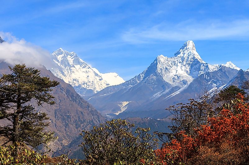
The Himalayas are the youngest mountain ranges forming the great mountain system in Asia. They create a barrier between the Tibet Plateau to the north and the Indian subcontinent alluvial plains to the south. The mountain range comprises of over fifty mountain peaks at elevations of 23,600 feet above sea level, including the world’s highest peak Mt. Everest. Himalayan ranges stretch uninterrupted for 1,550 miles from the west-northwest to the east-southeast of Nanga Parbat in Pakistani and Namjagbarwa in the autonomous region of China. Over 5 million people from Nepal, India, Bhutan, China, and Pakistan inhabit the Himalayas and accord the mountain ranges to have played a crucial role in their cultures.
What is the World’s Tallest Mountain Range?
The Himalayas are the youngest mountain ranges forming the great mountain system in Asia. They create a barrier between the Tibet Plateau to the north and the Indian subcontinent alluvial plains to the south. The mountain range comprises of over fifty mountain peaks at elevations of 23,600 feet above sea level, including the world’s highest peak Mt. Everest.
source http://fourteen.online/top-10-worlds-tallest-mountain-ranges/
from Dr. Linex https://ift.tt/30hKVi1
via IFTTT
0 comments:
Post a Comment